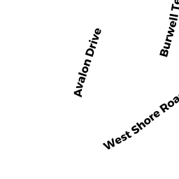
39 AVALON DRIVE
Owner Information
LEBOEUF PAUL D
160-23 97TH STREET
HOWARD BEACH, NY 11414


Property Details
39 AVALON DRIVE is classified as a Developable Residential Land (Vacant land).
39 AVALON DRIVE is valued at $2,000. The land is valued at $2,000 and the structures are valued at $0.
This property is in Zone NR. Confirm with local Zoning Board authorities to ensure there are no overlays or other easements on this property.
The most recent deed for 39 AVALON DRIVE is recorded at the local registrar in Book 5059, Page 0149. 39 AVALON DRIVE was last sold on Thursday, September 10, 1970 for $99.
Assessment data from fiscal year 2022.
Flood Data
According to the FEMA National Flood Hazard Layer, this property does not appear to be in a flood zone. It may also be in an area not yet reviewed. Nonetheless, confirm this information prior to taking any action.
To view the flood hazards around this property, create a FEMA "Firmette" Map of the area around 39 AVALON DRIVE.
Broadband Internet Providers
| Provider | Type | Bandwidth (mbps) | |
|---|---|---|---|
| Verizon New England Inc. | DSL | 5 | 0 |
| VSAT Systems, LLC. | Satellite | 2 | 1 |
| HughesNet | Satellite | 25 | 3 |
| GCI Communication Corp. | Satellite | 0 | 0 |
| T-Mobile | Fixed Wireless | 25 | 3 |
| Charter Communications Inc | Cable | 940 | 35 |
| Viasat Inc | Satellite | 100 | 3 |
Broadband service provider data from December 2020.
Adjacent Properties
- 37 AVALON DRIVE
Wet land, scrub land, rock land (Ch. 61A, not classified as Open Space) owned by T C P ENTERPRISES INC - 30 BURWELL TERRACE
Single Family Residential owned by PARADIS PAUL - 51 AVALON DRIVE
Productive Woodland (Ch. 61A, not classified as Open Space, with a Forest Management Plan); woodlots owned by T C P ENTERPRISES INC - 41 AVALON DRIVE
Wet land, scrub land, rock land (Ch. 61A, not classified as Open Space) owned by T C P ENTERPRISES INC